|
Weather Background & the National
Weather Service
|
||||||||||
|
|
|
|
|
|
|
|
|
|
||
 |
|
If you wish to find out more about weather, check out the University of Illinois' "WW2010" website.
They've got great "On-line guides" for:
You can learn A LOT about local weather from the National Weather Service (NWS) Office near you.
- Use the NWS Offices for the U.S. "clickable map" fo find the Forecast Offices located nearest to you.
| National Weather Service Forecast Office Gray, Maine |
- Aviation Weather
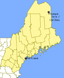
- Caribou National Weather Service Office
- Climate Information
- El Nino Information
- Express Weather for:
Augusta Bangor Bar Harbor Concord Lebanon Lewiston Portsmouth Portland - History of the National Weather Service
- Map of the WFO Gray Service Area
- Marine Weather
- ME
& NH Weather Information
- NOAA Weather Radio
- Other Links of Interest
- Our Portland Maine Mirror Site!
- Pictures:
Forecast office Great Ice Storm of '98 Deployment of wx buoy - The NWS Severe Weather Spotter
- Travel Weather
- "Watch" vs. "Warning" & Natural
Hazard Safety Rules
- Weather Graphics
Although each NWS office website is unique, many feature similar types of information.
We will visit the NWS Forecast Office in Gray, Maine website to see one example of the types of weather and climate data that are available on-line.
- Their top page is shown at right (>>>).
- Their area of coverage is seen by clicking on the "Map of the WFO Gray Service Area."
In this topic, we will focus on "Maine (ME) & New Hampshire (NH) Weather Information"
- "Climate Information" is covered in the previous topic.
- "Weather Graphics including Radar and Satellite imagery" is addressed in the next topic.
You might decide to visit or move to an area because you like its climate. For day-to-day planning, however, most people are interested in shorter-term weather information.
Go to Maine's NWS Forecast Office top page. Click on the "ME & NH Weather Information" link.
- You'll have a wide selection of data to choose from (VVV).
| Observations & Summaries |
| Area Forecast Discussion |
| Climate Data (Daily & Monthly) |
| Hydro Observer Observations |
| Coastal Buoy Data |
| Current Streamflow Data from USGS |
| Hourly (State Weather Roundup for New England) |
| Hydrologic Data |
| Marine Observations from Buoys and Ships |
| Ski Reports |
| State Weather Summary for ME & NH |
| Daily State Temperature and Precipitation Table |
- Tells you what has been observed recently, what is happening now and what
to expect in the next few hours.
- Click here to learn more about data from buoys.
| Forecasts |
| Aviation Forecasts |
| Marine Forecasts |
| Northeast Travelers Forecast |
| Short Term Forecast (nowcast) |
| State Forecast Product |
| White Mountain Summits Forecast |
| Zone Forecast Product |
| Zone Forecast Product by individual county |
- Predicts the type of conditions to expect in the next few days. There are also specific forecasts for pilots, boaters, travelers, mountain hikers, and skiers.
- Gives information, when needed, about potentially hazardous conditions.
| Statements and Warnings |
| Public Information Statements |
| Special Weather Statements for ME & NH |
| Watches and Warnings |
| Current NE River Statements and Warnings |
Key to understanding weather is learning about different weather measurements, how these measurements are made, and how they are incorporated into weather maps. To learn about these topics, click on the links to "Hands on" activities.
- Barometric Pressure: "Measuring Air Pressure With A Barometer"
- Dew Point: "Finding The Dew Point"
- Forecasts: "Forecasting Weather Using Wind-Barometric Tables"
- Fronts: "Following A Frontal System"
- Humidity: "Testing Humidity"
- Pressure Systems: "Effect Of Temperature On Air"
- Weather Stations: "Establishing A Weather Station" and "Student Weather Network"
- Weather Maps: "Reading & Creating A Weather Map"
- Wind: "Using The Beaufort Scale Of Wind Velocity"
Once you understand "basic" weather terminology, you might want to check out two good on-line summaries of Maine's weather: the "Area Forecast Discussion" and "State Weather Summary" (both highlighted in the table directly above).
- The "Area Forecast Discussion"
is an informative resource but BE WARNED ... this is written FOR
METEOROLOGISTS BY METEOROLOGISTS...
- ...who study weather, not meteorites!
- In old Greek, "meteoron" = "astronomical phenomenon" and "meteoros" = "high in the sky"
- ...who study weather, not meteorites!
- Below is an example from 28-July-98:
- "STG TSTMS ALG ROOFTOP OF ME ATTM PER SAT AND CBW 88D RADAR. THIS SHUD EXIT REGION NEXT CUPLE HRS AS MOVMNT RPDLY TO THE ENE. OTRW STILL CHC RW/TSTM NRN ME THRU THIS EVNG BFR BTR THREAT OF PCPN LATER TNGT. THE ACTIVITY IN NRN ME EXTNDS SSW THRU ME /BACK EDGE MLT TO AUG/ WITH THIS ACTIVITY EXPTD TO MOV THRU DOWNEAST ME THRU THIS EVNG WHERE CHC WL ALSO BE INCLUDED IN ZNS. OTRW FAIR WX THIS EVNG ACRS FA AS CU DSPTS WITH SUNSET."
- "MDLS BRG NEXT SHORT WAVE RPDLY INTO FA ON STG WESTERLIES WITH BEST CHC FOR SHWRS/TSTMS NRN ME AND LOWEST POPS OVR MORE SRN ZNS. TIMING BRGS PCPN IN LATE TNGT THEN TAILS OFF WED MRNG...BUT WITH CDFNT LAGGING BHD THREAT FOR PCPN CONTS THRU WED /AND INTO WED EVNG FOR MORE NRN ZNS OF ME/NH/. OTRW WED NGT BCMS P/CLDY OR M/CLR. MIX CLDS/SUN ON THU WITH CHC AFTN RW/TSTMS WITH ANOTHER 500 MB IMPULSE MOVG THRU THE WESTERLIES."
This is the "State Weather Summary" for the same date:
- "A WEAK AND DISSIPATING COLD FRONT MOVED THROUGH MAINE AND NEW HAMPSHIRE TODAY PRECEDED BY LOTS OF WARM AND MODERATELY HUMID AIR. THE FRONT TOUCHED OFF A FEW THUNDERSTORMS IN NORTHERN AND CENTRAL MAINE DURING THE AFTERNOON BUT OTHERWISE THERE WAS JUST A LOT OF HAZY SUNSHINE ACROSS THE TWO STATES WITH TEMPERATURES GETTING INTO THE 70S AND LOW TO MID 80S. SOUTH TO SOUTHWEST WINDS WERE ALSO BRISK AND GUSTY SO THE COOLEST TEMPERATURES OCCURRED ALONG THE DOWNEAST MAINE COAST."
- "TONIGHT THE SOUTHWEST FLOW WILL CONTINUE ACROSS THE NORTHEAST GIVING US GENERALLY FAIR MILD WEATHER FOR THE FIRST HALF OF THE NIGHT. AFTER MIDNIGHT... HOWEVER... ANOTHER COLD FRONT APPROACHING FROM THE WEST WILL BRING CLOUDS AND A THREAT OF SHOWERS AND THUNDERSTORMS BACK TO THE TWO STATES. THAT ACTIVITY WILL THEN LINGER IN MANY AREAS THROUGHOUT THE DAY WEDNESDAY AS THE FRONT MOVES SLOWLY EAST THROUGH THE REGION."
- "ON WEDNESDAY NIGHT SOMEHWHAT DRIER AIR WILL FILTER INTO MAINE AND NEW HAMPSHIRE AS THE FRONT MOVES AWAY OUT TO SEA. THAT WILL CLEAR OUT WHAT/S LEFT OF THE CLOUDS AND SHOWERS BY MORNING LEAVING US WITH A COOLER AND LESS HUMID DAY ON THURSDAY WITH JUST A CHANCE OF A FEW LATE DAY SHOWERS OR THUNDERSTORMS."
 |
- Compare the "Area Forecast
Discussion" with the "State
Weather Summary" for 28-July-98 (above, ^^^).
- Does reading the "Summary" make understanding the "Discussion" easier?
- Can you guess why meteorologists might prefer to communicate with each other using the "Discussion" format?
- See how much you learned about the meteorlogist
"shorthand" by reading TODAY'S "Area Forecast Discussion"
for Maine:
- Visit Maine's NWS Forecast Office site.
- Click on "ME & NH Weather Information".
- Click on "Area Forecast Discussion"
within "Observations & Summaries"
- Write down your interpretation of their text.
- Read it aloud to others who have seen today's
"State Weather Summary" which is available at
the same webpage.
- How well did you interpret the meteorologist's observations?
- Check out your local NWS Forecast Office website.
Begin at the NWS
Offices for the U.S. "clickable map"
- Do they feature both "Area Forecast
Discussions" and "State Weather Summaries"?
- If so, read and interpret their "Area Forecast Discussion."
- Check their "State Weather Summary" to see if you have interpreted it correctly.
- Do they feature both "Area Forecast
Discussions" and "State Weather Summaries"?
- Click here
to see a movie (903 K in size) about people whose jobs are made easier by
weather station information.
- Can you think of other professions that benefit from reliable weather forecasting?
 |
|
 |

 |
|
|
|
|
|
|||||||