 |
 |
||||||||||||||||||
|
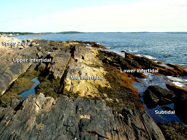
Distinct horizontal bands of organisms form visible zones within the rocky intertidal. All five of these zones can be seen in the image above. Can you identify them? Click on the image to see if you were right.
Not all rocky shores look like this one. The geology of intertidal areas range from long stretches of solid rock and ledge like the one seen above to... |
|||||||||||||||||||
Consider this... - Which zone is exposed for the longest period of time? - Make a list of factors that the organisms in this exposed zone must adapt to in order to survive. |
|||||||||||||||||||
|
|||||||||||||||||||