|
Color Landform Atlas of the United
States
|
||||||||||
|
|
|
|
|
|
|
|
|
|
||
 |
|
A "Color Landform Atlas of the United States" is available from the Johns Hopkins University's Applied Physics Laboratory Ocean Remote Sensing Group.
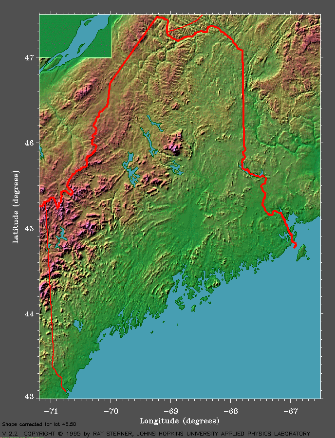
- The relief map of Maine at right (>>>) was created from existing elevation data.
- Another name for the physical elevation features shown is "topography."
- For these maps, computer software was used to make things easier to see.
Such computer-generated enhancements are called "visualization techniques."
- In this image, two "visualization" techniques are used
to make the topography easier to see:
- Color-coding of different elevations
- "False" shading -- or computer-generated shadows
- In this image, two "visualization" techniques are used
to make the topography easier to see:
- Satellite images are available that show vegetation patterns for each U.S. state are also available from the "Color Landform Atlas of the United States" website.
 |
- Click on the topography map above to see a larger version.
- Look at the shading -- or false shadows -- on
this map.
- From what direction is the map being illuminated? (In other words, from what direction is the "false" light source coming?)
- Is this consistent with the direction that natural sunlight might shine?
- Examine the relationship between colors and elevation.
- Use either the map of Maine provided or access the "Color Landform Atlas of the United States" website to choose any state.
- What color represents the near-sea-level elevations?
- What color represents your chosen state's higher landforms?
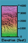
- What is the (approximate) elevation of this
point?
- Click
here to see the scale for the Maine
topography map.
- Does this scale provide enough information to know the exact height of Maine's highest point?
- Note that the color-coded scale for Maine's
topography generally follows the color spectrum of the rainbow:
(HIGHEST) Magenta => Red => Orange => Yellow => Green
(LOWEST).
- Print the Maine topograpy map in black-and-white.
Choose a small subset of the state that has a wide range of
elevtion change. With the color version of the map as a guide,
color the black-and-white print with SUBSTITUTE colors as follows:
- Magenta becomes Red
- Red becomes Green
- Orange becomes Yellow
- Yellow becomes Magenta
- Green becomes Orange
- Is the color-coding of this map as easy to interpret as the original one?
- Print the Maine topograpy map in black-and-white.
Choose a small subset of the state that has a wide range of
elevtion change. With the color version of the map as a guide,
color the black-and-white print with SUBSTITUTE colors as follows:
- Click
here to see the scale for the Maine
topography map.
- Consider how your chosen state's overall elevation
range (variation from lowest to highest) compares to a few other states.
- How do you think its elevation range compares
to that of:
- Texas? (In other words, is your chosen state's elevation range greater than, less than, or about equal to that of Texas?)
- Rhode Island?
- Hawaii?
- Kansas?
- Alaska?
- Other states that the students have visited?
- Go to the Color Landform Atlas of the United States website and check your answers.
- For each state you investigate at this
website, also compare the "on-line maps" vegetation
patterns to topography.
- Do you think that a state's elevation
range has an affect on its vegetation patterns?
- If so, how?
- What about its weather patterns?
- Click here to see a movie about one way elevation can affect weather: by "orographic precipitation."
- Do you think that a state's elevation
range has an affect on its vegetation patterns?
- How do you think its elevation range compares
to that of:
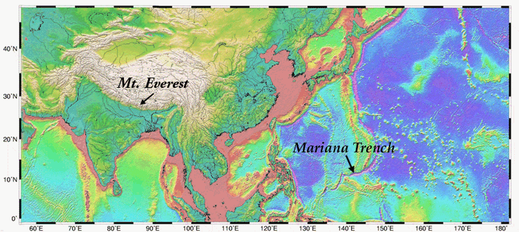
- Which do you think is shows more variation -- or change -- from sea level:
-
Mt. Everest (highest land elevation) or the Mariana Trench (deepest ocean trench)?
- Why did you choose this feature?
- Click here to see
a color-coded map with arrows that point to Mt. Everest and the Mariana
Trench.
- Does this help you to answer the question?Why or why not?
- [If you need more help discovering which of these features has more variation from sea level, you may want to check an atlas or world almanac.] To learn more about topography of the sea floor, go to the "Bathymetry" section.
 |
|
|
 |
 |
|
|
|
|||||||||