 |
|
Our Route |
|
Our
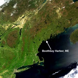
cruise begins as we set out from Boothbay Harbor, Maine, U.S.A. (43:51:16
N; 69:37:29 W). Boothbay Harbor is a small scenic town on the coast of the Gulf of Maine. |
|
 Image
courtesy of NASA's Visible Earth. Image
courtesy of NASA's Visible Earth. |
|
|
|
Our research vessel is the R/V Cape Hatteras, operated by the Duke/University of North Carolina Oceanographic Consortium. |
||
|
|
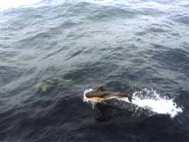
It’s a beautiful day to go to sea. High school teacher Polly Wilson and Chief Scientist Mike Sieracki take a last look back at Boothbay Harbor as the 2-week cruise begins. We even receive a dolphin escort as our journey gets underway. |
 |
|
After leaving the harbor, we steam south out of the Gulf of Maine and into the Atlantic. We travel for several days until we reach our first station – the Open Ocean Station. This map shows you our course. The red line is the path of our ship. From the Open Ocean Station we take an indirect path back to the Gulf of Maine, hitting several other stations (including the Upwelling Zone and Continental Shelf Stations) along the way. Finally, after 14 days at sea, we step back on dry land as we dock in Portland, Maine (43:40:02 N; 70:12:26 W). |
|