| Station Description |
| 01042500 KENNEBEC RIVER AT THE FORKS,
MAINE |
| LOCATION.--Lat 45 20'45", long 69 57'48",
Somerset County, Hydrologic Unit 01030001, on right bank at The Forks, 0.4
mi upstream from highway bridge and 0.7 mi upstream from Dead River. |
| DRAINAGE AREA.--1,590 mi^2. |
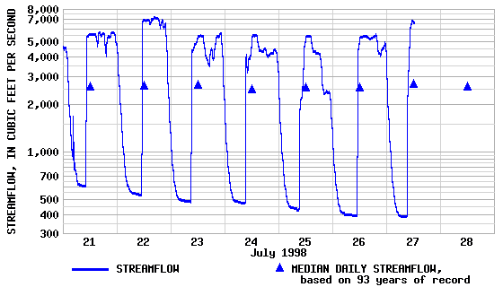
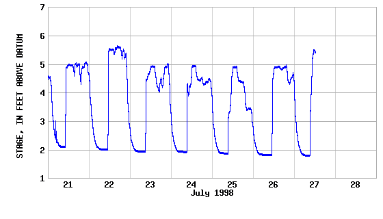
| PERIOD OF RECORD.--Discharge: October 1901
to current year. Prior to Oct. 1903 monthly discharge only, published in
WSP 1302. Chemical analyses: Water years 1952-53. |
| GAGE.--Water-stage recorder. Datum of gage
is 569.03 ft above National Geodetic Vertical Datum of 1929. Prior to June
21, 1912, nonrecording gage, and June 21, 1912, to Oct. 17, 1919, water-stage
recorder and nonrecording gage at highway bridge 0.4 mi downstream at different
datum. |
| REMARKS.--Records excellent. Flow regulated
by Moosehead Lake, Brassua Lake, and Indian Pond. Satellite gage-height
telemeter at station. |