|
|
MATERIALS
|
|
| |
PROCEDURE
|
|
| |
|
|
Activity
- Discuss latitude and longitude using the globe or world map
as a reference point.
- Have students identify the latitude and longitude of the region
in which they live.
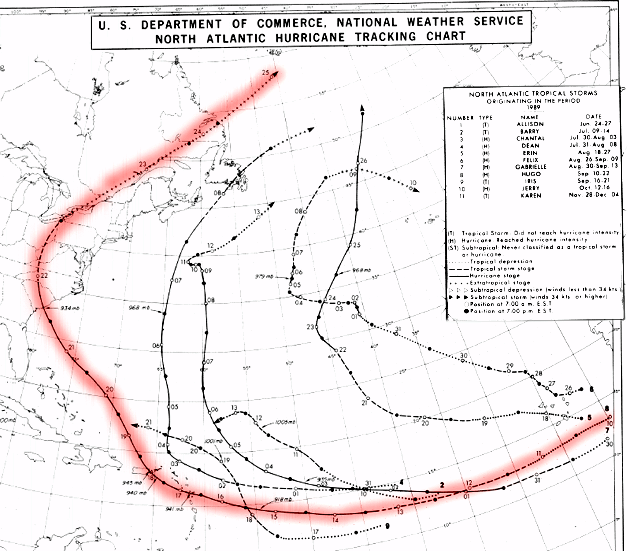
- Review images from Hurricane Hugo (provided
below).
- Click here to see an animation of Hugo
approaching the U.S. eastern seaboard (774 K)
- Distribute the hurricane path data table
to students. Practice plotting latitude and longitude; In the
Hurricane Hugo Data table.
- Latitude is given in degrees north
- Longitude is given in degrees west
- Time is given in UTC (also known as Greenwich Mean Time).
- Greenwich, England is globally accepted as a reference
standard for both time and longitude (its
location marks zero degrees longitude). GMT is based on
a 24-hour clock.
- Eastern Daylight Time (EDT) is GMT minus 4 hours
- Have the students plot the hurricane's day-to-day path as it
moved toward the U.S. eastern seaboard. They should mark each
location with the maximum wind speed (given in knots, in
the table below) and minimum
central pressure (given in millibars, in the table
below).
- Connect the storm's daily locations with a pencil and analyze
its movement. Was the storm a tropical cyclone? Where did it originate?
(HINT: Tropical cyclones do not develop at the equator because
at 0° latitude the Coriolis Effect
does not provide enough spin to initiate hurricane conditions.
Hurricanes generally develop at just north or south of the equator
within low-pressure troughs in the trade wind belts.)
|
|
| |
Assessment Ideas
- Have students chart the practice data for hurricane Hugo in
their journals. Watch the weather reports and satellite printouts
for the formation of a hurricane. Once a hurricane has been named,
track the storm for its entire life. See if you can predict how
large and where it will go.
|
|
|
|
| |
CROSS-CURRICULAR IDEAS
- Physics: Discuss why most storms and fronts travel basically
from west to east. Why don't hurricanes generally travel in manner?
- History/Social Studies (Research Topic): What is the impact
of a class 5 hurricane? What are the ten largest hurricanes in the Northern
Hemisphere and what were their impacts on the United States?
- Mathematics: Calculate the rate of speed, acceleration and
deceleration of the hurricane you are tracking. What factors influence
this characteristics of a hurricane?
|
|
| |
VOCABULARY
- Coriolis Effect: occurs in both hemispheres. In the Northern
Hemisphere, motion is deflected to the right from its initial path;
in the Southern Hemisphere motion is deflected to the left of its initial
path. (Click here to see an animation of
the Coriolis Effect.)
- hurricane: a low-pressure cyclone or tropical storm with winds
exceeding 70 miles per hour. The "whirlwind" formation may
exceed a diameter of 300 miles and have a capability of releasing more
energy per minute than a hydrogen bomb.
- latitude: the distance north or south from the equator measured
through 90° degrees.
- longitude: the distance east or west from the prime meridian,
which is 0° longitude and located at Greenwich, England.
|
|
| |
SOURCE
- Adapted from "Winds of Change" educational CD-ROM, Copyright
Caltech and NASA/Jet Propulsion Laboratory
|
|
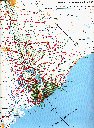 |
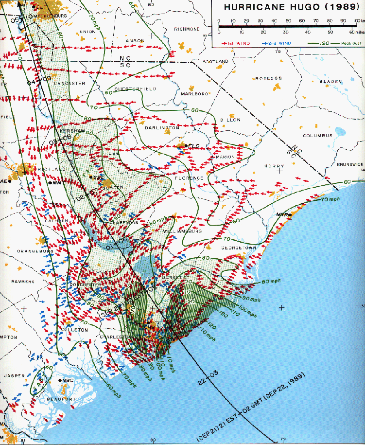
Map of Hugo's Path across
South Carolina.
[Click on image to see a larger version.]
|
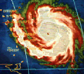 |
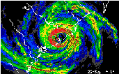
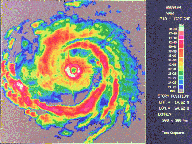
Infrared image: Hugo near peak intensity, September 15, 1989.
[Click on image to see a larger version.]
|
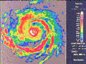 |
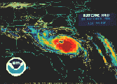
NOAA P-3 radar image: Hugo near peak intensity, September 15,
1989.
[Click on image to see a larger version.]
|
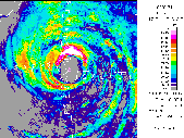 |
NOAA P-3 radar image: Hugo over the northeast Caribbean, September
17, 1989.
[Click on image to see a larger version.]
|
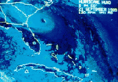 |
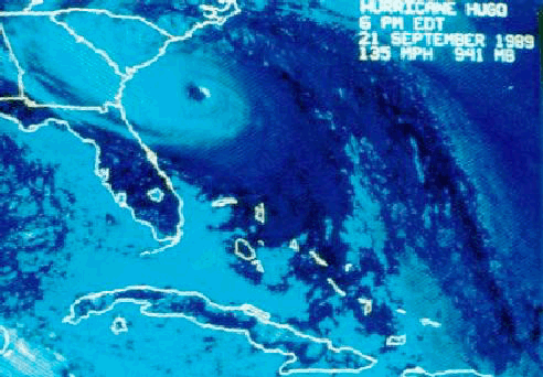
Last-light visible image: Hugo approaching South Carolina, September
21, 1989
[Click on image to see a larger version.]
|
 |
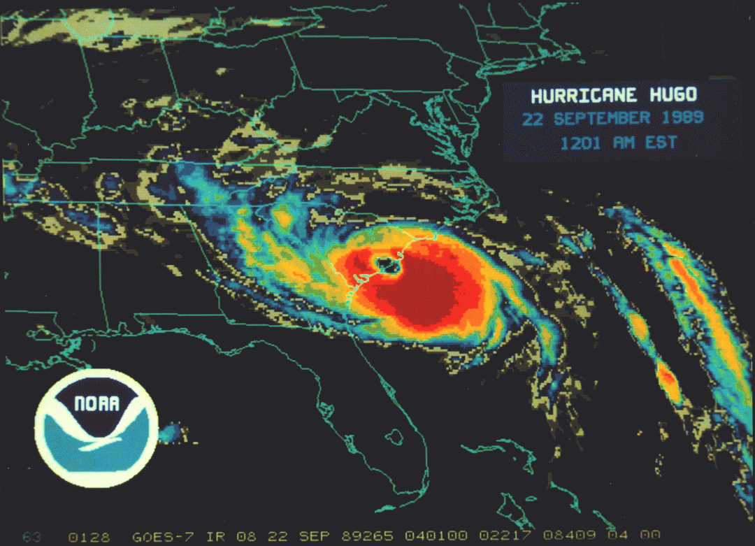
Infrared image: Hugo making landfall, September 22, 1989. Courtesy
of NOAA's National Enivironmental Satellite, Data, and Information Service.
[Click on image to see a larger version.]
|
 |
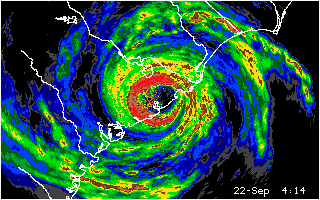
Charleston, South Carolina image: Hugo making landfall, September
22, 1989.
[Click on image to see a larger version.]
|

